Gregory Bald
Flame azaleas in late June · 11.6-mile round trip
A rare treeless summit in the Smokies, with open views over Cades Cove and Fontana Lake from a grassy meadow at 4,949 feet. Late June is the draw, when wild flame azaleas bloom across the bald in red, orange, pink and yellow. Getting there is a full day — roughly 3,000 feet of climbing over 11.6 miles.
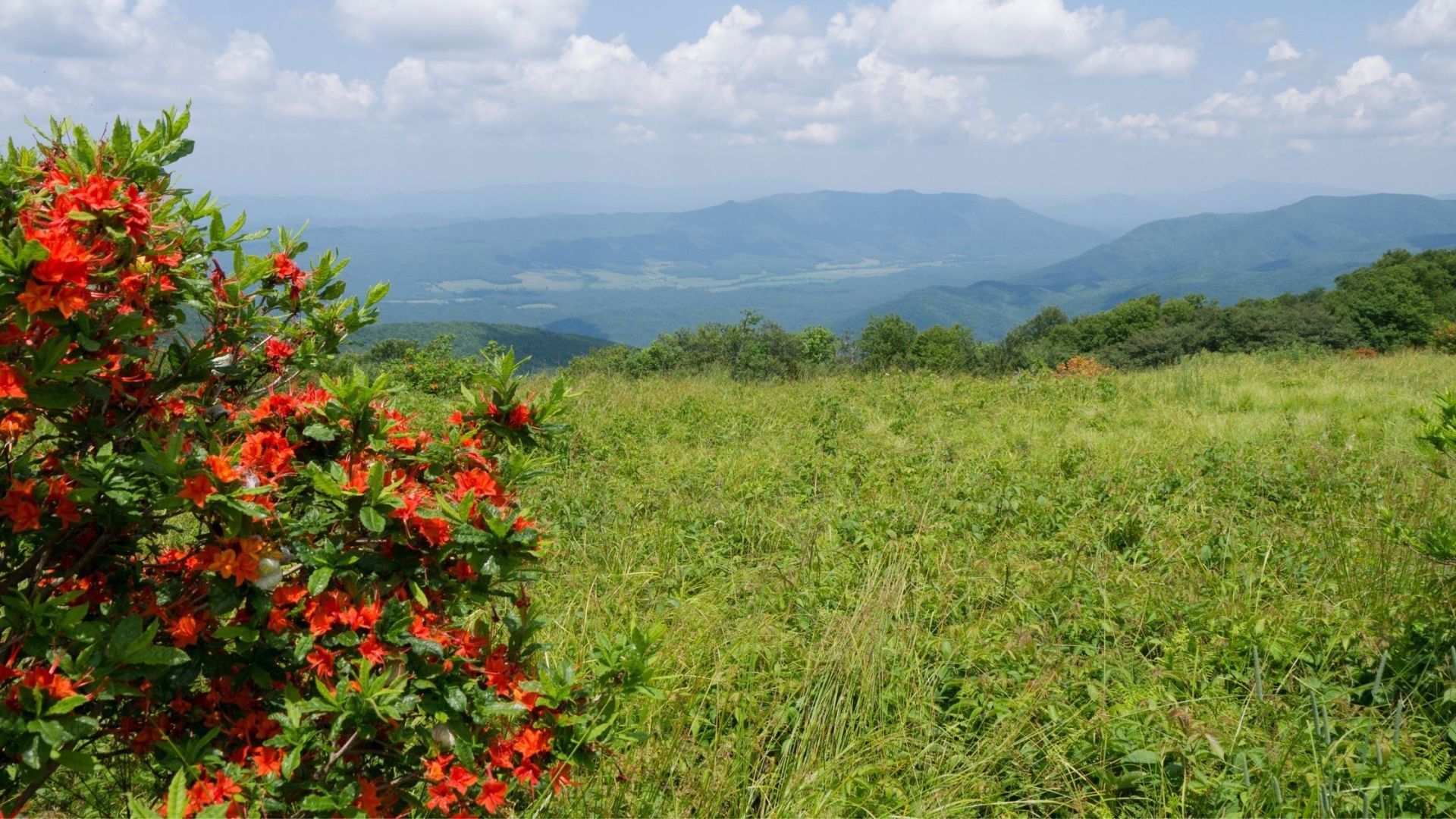
Gregory Bald is one of the great rewards in the Great Smoky Mountains: a wide, grassy meadow on top of a mountain nearly 5,000 feet high. In June it's covered in blooming flame azaleas, and on clear days it looks out over Cades Cove and miles of Smoky Mountain ridges.
Getting there takes real effort. The most popular route, the Gregory Ridge Trail, is a full-day hike of about eleven miles round trip. For hikers ready for the challenge, few places in the park feel more special.
Gregory Bald hike at a glance
Distance: about 11 miles round trip
Climb: about 3,000 feet
Summit elevation: 4,949 feet
Difficulty: strenuous, full-day hike
Trailhead: end of Forge Creek Road in Cades Cove
Pets: not allowed on this trail
Finding the Gregory Ridge trailhead
The Gregory Ridge trailhead is in Cades Cove, at the parking area at the end of Forge Creek Road. Forge Creek Road branches off the Cades Cove Loop Road near the far end of the loop. Traffic on the loop moves slowly, especially when wildlife is spotted, so leave extra time to reach the trailhead and start your hike early.
Bring a parking tag — a national park parking tag is required for any vehicle parked longer than fifteen minutes. See our guide to where to buy a Smokies parking pass.
You may see older guides mention a shorter route from Parson Branch Road. That road is closed to cars, so the Gregory Ridge Trail from Cades Cove is the standard way up for day hikers.
What the hike is like
Forge Creek and old-growth forest
The first couple of miles follow Forge Creek through shady forest, crossing the stream on footlog bridges and passing some impressive old-growth trees. Backcountry campsite 12 sits about 1.9 miles in, near the last stream crossing.
The long climb up Gregory Ridge
After the campsite, the trail leaves the creek and starts a long, steady climb up Gregory Ridge. This is the hardest part of the hike, with most of the elevation gain packed into the next three miles. Take your time, rest when you need to, and keep drinking water.
Rich Gap to the bald
At about 4.9 miles, the Gregory Ridge Trail ends at Rich Gap on the Tennessee and North Carolina state line. Turn right onto the Gregory Bald Trail for the last 0.6 miles to the top. The trees open up, and you step out onto the grassy bald.
Flame azaleas and summit views
Gregory Bald is best known for its flame azaleas. In mid to late June the bald blooms in shades of orange, red, pink, yellow, and white, one of the most famous wildflower displays in the Smokies. Bloom timing changes a little every year, so check recent reports before planning your trip around it.
Any time of year, the views are the reward. Look down into Cades Cove and out across layer after layer of mountains in Tennessee and North Carolina. Bring a lunch, find a spot in the grass, and enjoy it. You've earned it.
Tips for hiking Gregory Bald
Start early — this is an all-day hike, and you'll want plenty of daylight for the trip down.
Pack enough water and food — there's no water at the top, and the climb is long. Bring more than you think you'll need.
Dress in layers — the summit is often cooler and windier than Cades Cove, even in summer.
Watch for wildlife — deer, wild turkeys, and black bears live along the trail. Give every animal plenty of space and never feed them.
Plan ahead for an overnight — camping in the backcountry requires a park permit, and some campsites near the bald need a reservation.
Best time to hike Gregory Bald
June — flame azalea season, and the most popular time to make the hike.
Summer — long days, though afternoon storms are common on high ground, so keep an eye on the sky.
Fall — clear air, cooler hiking, and changing leaves across Cades Cove below.
Winter can bring ice and snow at higher elevations. Check trail and road conditions with the national park before any visit.
More to explore near Cades Cove
If you're heading to Cades Cove, make the most of the trip. Abrams Falls is a moderate hike to one of the park's most powerful waterfalls, and our guide to the must-see sights along the Cades Cove Loop covers the cabins, churches, and wildlife viewing along the drive. Love grassy balds? Andrews Bald near Clingmans Dome is a shorter hike to another beautiful mountain meadow. Browse all our Smoky Mountain hiking trails for more ideas.
Frequently asked questions
How long is the hike to Gregory Bald?
About eleven miles round trip via the Gregory Ridge Trail from Cades Cove. The summit is about 5.5 miles from the trailhead.
How hard is the Gregory Bald hike?
It's strenuous. The trail climbs about 3,000 feet, most of it on Gregory Ridge, so plan for a full day.
When do the azaleas bloom on Gregory Bald?
Usually mid to late June, though timing changes a little from year to year.
Where is the Gregory Ridge trailhead?
At the end of Forge Creek Road, which branches off the Cades Cove Loop Road.
How high is Gregory Bald?
The summit sits at 4,949 feet.
Can I bring my dog?
No. Dogs aren't allowed on Gregory Bald trails or most other trails in the national park.
Make Gregory Bald the highlight of a Smoky Mountain vacation. Our cabins near Cades Cove and Wears Valley cabins put you close to the trailhead for an early start. After a long day on the trail, rest in one of our hot tub cabins or enjoy the scenery from our mountain view cabins. Bringing the dog? Our pet-friendly cabins welcome them too.