Rainbow Falls
80-foot falls · 5.6-mile round trip
The tallest single-drop waterfall in the Smokies — eighty feet of it — reached by a steep, rocky climb of about 1,500 feet. On sunny afternoons the mist throws a rainbow across the base, which is where the name comes from. Parking at the Cherokee Orchard Road trailhead is tight and fills fast, so come early.
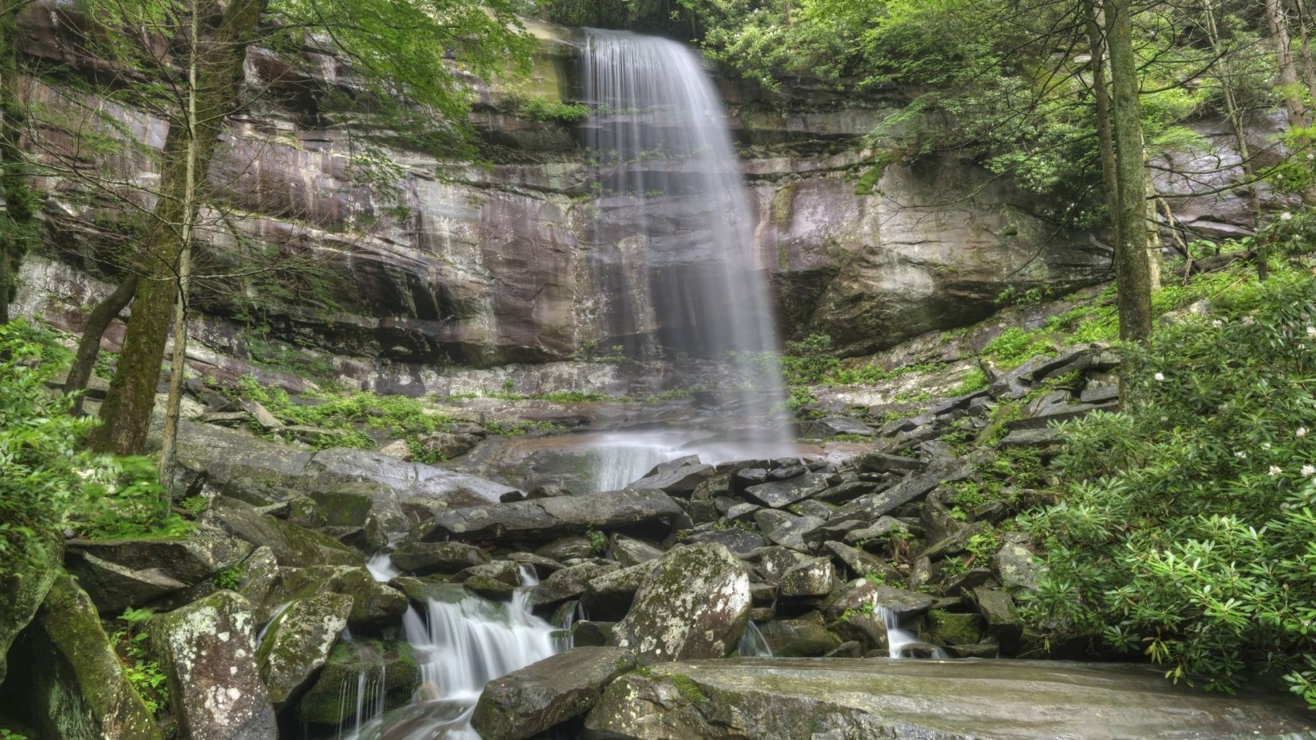
At about 80 feet, Rainbow Falls is the highest single-drop waterfall in the Great Smoky Mountains. On sunny afternoons, the mist rising from the falls catches the light and forms the rainbows that give it its name.
The Rainbow Falls Trail starts just minutes from downtown Gatlinburg and climbs steadily through the forest for about 2.8 miles to the falls. It's a real workout, but it's one of the most rewarding waterfall hikes in the park.
Rainbow Falls Trail at a glance
Climb: about 1,500 feet
Falls height: about 80 feet
Difficulty: moderate to strenuous, steep and rocky
Trailhead: Rainbow Falls trailhead on Cherokee Orchard Road, Gatlinburg
Pets: not allowed on this trail
Finding the Rainbow Falls trailhead
From traffic light number eight in downtown Gatlinburg, turn onto Historic Nature Trail Road and enter the national park. Bear right onto Cherokee Orchard Road and continue to the Rainbow Falls trailhead, which has an upper and a lower parking area. The same road leads into the Roaring Fork Motor Nature Trail.
Arrive early — this is one of the busiest trailheads in the park, and parking fills quickly. The park recommends taking a shuttle when the lots are full.
Bring a parking tag — a national park parking tag is required for any vehicle parked longer than fifteen minutes. See our guide to where to buy a Smokies parking pass.
Restrooms — there are pit toilets at the trailhead.
What the hike is like
The Rainbow Falls Trail climbs steadily from the start, following LeConte Creek through hardwood forest and rhododendron. It gains about 1,500 feet on the way to the falls, so expect a steady uphill with plenty of rocks and roots underfoot. Footbridges cross the creek along the way.
Take your time and rest when you need to. The trail is steep in places, and the rocks can be slick when wet. You'll also see reminders of the 2016 wildfire along parts of the trail, along with the forest growing back.
At the falls
Rainbow Falls drops about 80 feet over a rocky ledge into the creek below. Visit on a sunny afternoon for your best chance to see a rainbow in the mist. The falls run strongest after a good rain, and on very cold winter days they can freeze into a wall of ice.
Continuing to Mount LeConte
Strong hikers can keep going past the falls. The Rainbow Falls Trail continues about four more miles to the top of Mount LeConte, one of the tallest peaks in the Smokies, for a full-day hike of more than thirteen miles round trip. During high water, the park suggests the Bullhead Trail as an alternate route. For another way to the summit, see our guide to the Alum Cave Trail to Mount LeConte.
Tips for your hike
Start early — you'll get better parking, cooler temperatures, and a quieter trail.
Wear real hiking shoes — the trail is steep and rocky the whole way.
Carry plenty of water — the climb is steady, and there's no water to fill up along the way.
Plan for the rainbow — if seeing the rainbow is your goal, aim to reach the falls on a sunny afternoon.
Best time to hike Rainbow Falls
Spring — wildflowers bloom along the trail and the falls run full.
Summer — the shady forest helps on the climb. Start early to beat the heat and the crowds.
Fall — colorful leaves line LeConte Creek. Plan a leaf-season trip with our fall cabin rentals.
Winter — the falls can freeze into a dramatic ice sculpture, but the trail is often icy. Check conditions with the national park first.
More waterfall hikes near Gatlinburg
Gatlinburg is surrounded by great waterfall hikes. Nearby on Roaring Fork, Grotto Falls lets you walk behind the water, and Baskins Creek Falls is a quieter option. Laurel Falls and Porters Creek Trail are favorites too, and Ramsey Cascades is the tallest waterfall in the park. See our roundup of waterfalls near Gatlinburg or browse all our Smoky Mountain hiking trails.
Frequently asked questions
How long is the Rainbow Falls hike?
About 5.6 miles round trip from the trailhead on Cherokee Orchard Road.
How tall is Rainbow Falls?
About 80 feet. It's the highest single-drop waterfall in the Great Smoky Mountains.
How hard is the Rainbow Falls Trail?
It's a steady, steep climb of about 1,500 feet with rocky sections, moderate to strenuous for most hikers.
Where is the Rainbow Falls trailhead?
On Cherokee Orchard Road, just outside downtown Gatlinburg. Take Historic Nature Trail Road from traffic light number eight.
When can you see the rainbow at Rainbow Falls?
On sunny afternoons, when the sunlight hits the mist rising from the falls.
Can I bring my dog?
No. Dogs aren't allowed on the Rainbow Falls Trail.
Rainbow Falls starts just minutes from downtown, so our Gatlinburg cabins put the trailhead right around the corner. Our cabins near the national park keep the trails close, and our mountain view cabins let you enjoy the scenery long after the hike. After the climb, rest your legs in one of our hot tub cabins, and if the dog is coming along, our pet-friendly cabins welcome them too.