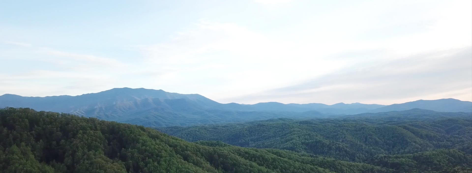
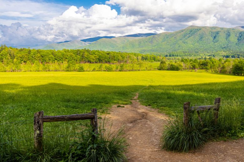
Cades Cove is the most visited destination in Great Smoky Mountains National Park — and while most people come for the 11-mile loop road and the wildlife, the trails that branch off from the Cove are among the finest hiking in the entire Smokies. From a flat family nature walk to a grueling summit rewarded with flame azaleas stretching across a mountaintop, here's your complete guide to the best hikes in Cades Cove.
Before You Go: Practical Information
Parking: While there is no entrance fee to the park, a paid parking tag is required for those who park for longer than 15 minutes. You may purchase a daily, weekly, or annual tag online or at the visitor's center. Daily tags are $5.
Wednesday road closure (May–September): The Cades Cove Loop Road is closed to vehicles every Wednesday from early May through late September — bike and pedestrian access only. If you're driving to a trailhead, avoid Wednesdays during this window.
Check conditions: The NPS posts current closures and conditions at nps.gov/grsm — always check before your visit, especially after heavy rain.
Directions: From Gatlinburg, follow Little River Road west approximately 25 miles. From Pigeon Forge, take Wears Valley Road (US-321) through Townsend and follow signs for Cades Cove.
1. Cades Cove Nature Trail
Distance: 2.0 miles round-trip | Difficulty: Easy | Elevation gain: Minimal | Best for: Families, first-time visitors, young kids
The ideal first hike in Cades Cove — short enough for young children, beautiful enough to satisfy experienced hikers looking for a peaceful morning walk. The trail winds through lush mixed forest, follows a pretty stream for much of its length, and crosses a charming log bridge that becomes a photo stop for nearly every family that passes it.
Wildlife is common along this trail: white-tailed deer, wild turkeys, and groundhogs frequently appear in the meadow edges, and black bears have been spotted by lucky visitors on early morning walks.
Trailhead: Located approximately 7 miles into the 11-mile Cades Cove Loop Road. Parking is available directly at the trailhead.
Tips: Go early morning for the best wildlife activity and softest light. Works beautifully as a warm-up before the drive around the loop road.
2. Anthony Creek Trail
Distance: 2.4 miles round-trip | Difficulty: Easy | Elevation gain: ~200 ft | Best for: Families, picnic day-trippers, dogs on leash
One of the most accessible trails in the Cove, starting right from the Cades Cove Picnic Area — meaning you can combine a hike with a picnic lunch before or after. The trail follows Anthony Creek through shaded mixed forest, passing several small cascades along the way.
This trail also serves as a natural gateway for longer backpacking routes deeper into the park — Anthony Creek connects to Bote Mountain Trail and eventually the Appalachian Trail. For day hikers, the 2.4-mile out-and-back is the sweet spot.
Trailhead: Cades Cove Picnic Area, near the beginning of the loop road. Restrooms available at the picnic area.
Tips: A great alternative if Abrams Falls parking is full. The picnic area facilities make this the most family-practical trailhead in the Cove.
3. Abrams Falls Trail
Distance: 5.2 miles round-trip | Difficulty: Moderate | Elevation gain: ~600 ft | Best for: Active families, waterfall seekers, nature lovers
One of the most popular hikes in Cades Cove, this moderately challenging trail leads to Abrams Falls, one of the most scenic waterfalls in the Smoky Mountains. The 20-foot-high falls cascade into a large pool, creating a spectacular sight.
Abrams Falls is named after a Cherokee chief who once had a village downstream — a piece of history that gives the destination real weight. The trail navigates through a pine-oak forest throughout the ridge tops, with hemlock and rhododendron thickets close to the creek edge. Despite being only 20 feet tall, the falls are extraordinarily powerful — Abrams Creek drains one of the largest watersheds in the park, making the cascade thunderously loud and dramatic in any season.
The trail has tree roots and rock obstacles along the way, and creek crossings on stepping stones add a little adventure. Most reasonably fit hikers complete it comfortably in 2.5–3 hours.
Trailhead: Drive five miles on the Cades Cove Loop Road to stop #10. After crossing Abrams Creek, turn right onto a gravel road running through a grassy field. The turnoff is signed.
Tips: Arrive early — this is one of the most popular trails in the park and the parking area fills by mid-morning on weekends. Bring water shoes if you want to wade at the pool. Check nps.gov/grsm for current trail conditions before visiting.
4. Rich Mountain Loop Trail
Distance: 8.5 miles round-trip | Difficulty: Moderate–Strenuous | Elevation gain: ~1,600 ft | Best for: Experienced hikers, spring wildflower seekers, history lovers
The most rewarding full-day hike in Cades Cove for those who want more than a waterfall. Close to the start, you enter a gorgeous meadow famed for spring and summer blossoms. The trail also passes the historic John Oliver Cabin — the oldest human structure in the national park, a hand-hewn log cabin built by Cades Cove's first permanent settler — before climbing the forested ridge of Rich Mountain.
This hike is famous for stunning wildflower displays in late spring and early summer — trillium, wild geranium, and phacelia carpet the forest floor in April and May. The ridge offers views back across the open valley of Cades Cove that are worth every foot of elevation gained.
Trailhead: Near the parking lot at the start of the Cades Cove Loop Road.
Tips: Can be done as a shorter out-and-back to the meadow and John Oliver Cabin (about 2 miles) if the full 8.5-mile loop feels too ambitious. The full loop takes 4–5 hours at a comfortable pace. Start early.
5. Gregory Bald Trail
Distance: 11.3 miles round-trip | Difficulty: Strenuous | Elevation gain: ~3,000 ft | Best for: Serious hikers, late June azalea season, summit views
The crown jewel of Cades Cove hiking. A "bald" is a natural mountaintop meadow — treeless, wind-swept, and offering 360-degree views of the surrounding Smoky Mountain ridges. Gregory Bald sits at 4,948 feet and hosts what many consider the finest display of wild flame azaleas in the Eastern United States.
In azalea season, the experience of Gregory's Bald is unmatched — it is ablaze with breathtaking masses of orange and wine-colored blooms. Peak bloom typically runs late June. In the days of old, Cades Cove farmers used to graze their cattle on Gregory's Bald, cattle being one of their best cash crops — history you'll think about as you stand on that open summit.
Trailhead: Turn right out of the Cable Mill area parking lot and proceed to Parson Branch Road. The parking area marked Gregory Ridge Trail is about five miles down at Sam's Gap.
Tips: A serious all-day commitment — allow 6–8 hours and start at first light. Bring plenty of water (no reliable water source on the upper trail), extra layers for the summit, and high-energy food. Not recommended for casual hikers. Best visited late June for azalea peak or October for fall foliage views.
6. Lynn Camp Prong Trail
Distance: 1.6 miles round-trip | Difficulty: Easy | Elevation gain: ~150 ft | Best for: Easy waterfall walk, families, older hikers
A hidden gem in the Tremont area just outside the Cove that most visitors drive past without knowing it exists. Lynn Camp Prong rushes and tumbles over numerous cascades as it flows down the mountain. The trail follows the route of an old logging railroad, offering easy walking on a wide, relatively level path. Wildflowers bloom along the trail from spring through summer.
The old railroad grade makes this one of the smoothest trail surfaces in the Smokies — ideal for hikers who want a waterfall experience without technical terrain. The trail begins at a long, high footbridge across the river, which is its own dramatic opening act.
Trailhead: From the Townsend Wye, take Laurel Creek Road 0.2 miles toward Cades Cove and turn left at the sign for Tremont. Follow the road past the Great Smoky Mountains Institute at Tremont, continuing 3 miles to the small parking area at the end of the road.
Tips: Combine with a Cades Cove loop road visit on the same day — the Tremont turnoff is just minutes from the Cove entrance. One of the best easy waterfall hikes in the entire park.
Seasonal Hiking Guide
Spring (March–May): Wildflowers peak on Rich Mountain Loop in April–May. Waterfalls run fullest after spring rains. Comfortable hiking temperatures before summer heat arrives.
Summer (June–August): Late June is prime time for Gregory Bald flame azaleas. Start all hikes early to beat afternoon heat and thunderstorms, which typically build after 2 PM. Abrams Falls swimming hole is at its most popular.
Fall (September–November): Fall foliage peaks mid-October and turns Cades Cove into one of the most spectacular landscapes in the East. Gregory Bald summit views are clearest in autumn. Crowds thin after mid-October.
Winter (December–February): Snow occasionally dusts the Cove and the trails, creating a beautiful but more demanding experience. Check conditions before attempting longer hikes. Gregory Bald and Rich Mountain Loop may be icy above 3,000 feet.
Tips for Hiking in Cades Cove
Arrive at opening (8 AM). The most popular trailheads — Abrams Falls especially — fill by mid-morning on summer and fall weekends. Arriving early gets you the best parking, the coolest temperatures, and the most active wildlife.
Download offline maps. Cell service is limited throughout the Cove. Download AllTrails or Google Maps offline before leaving your cabin.
Bring the essentials. Water (at least 1 liter per person on Abrams Falls; more on Gregory Bald), snacks, sunscreen, insect repellent, a light rain layer, and proper hiking footwear. Sandals and flip-flops are not appropriate for any trail on this list.
Wildlife encounters. Bears, deer, and turkeys are common on all Cades Cove trails. Maintain the 50-yard distance rule and never approach or feed wildlife. If you encounter a bear on the trail, make noise, stand tall, and back away slowly.
Combine hiking with the loop road. The most satisfying Cades Cove days start with a morning hike while energy is high, then transition to the leisurely wildlife drive in the afternoon.
Frequently Asked Questions
What is the best beginner hike in Cades Cove? The Cades Cove Nature Trail (2 miles, easy) is the best starting point for first-timers and families with young children. Anthony Creek Trail (2.4 miles, easy from the picnic area) is another excellent option.
What is the best beginner hike in Cades Cove? The Cades Cove Nature Trail (2 miles, easy) is the best starting point for first-timers and families with young children. Anthony Creek Trail (2.4 miles, easy from the picnic area) is another excellent option.
When is the best time to hike Gregory Bald? Late June for the famous flame azalea bloom — one of the most spectacular natural events in the Smokies. October for clear summit views and fall foliage color.
How far is Cades Cove from Gatlinburg? About 25 miles via Little River Road — roughly an hour's drive. From Pigeon Forge via Wears Valley Road (US-321) through Townsend is similar in time and arguably more scenic.
Is there a fee to hike in Cades Cove? There is no entrance fee, but a paid parking tag ($5 daily) is required for anyone parking longer than 15 minutes.
Stay Close to the Trails
Cades Cove rewards an early start — which is a lot easier when you're staying in a Smoky Mountain cabin rental just an hour away. Pack a trail lunch in the cabin kitchen the night before, set your alarm, and be at the Abrams Falls trailhead before the crowds arrive.
Colonial Properties has Cades Cove cabin rentals and cabins near the National Park across Gatlinburg, Pigeon Forge, and Sevierville — ranging from cozy 1-bedroom couples' cabins to large group lodges.
Browse Cades Cove Cabins → | Browse Cabins Near the Park → | Browse All Cabins →